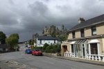
The Rock of Cashel is an 12th century church, built upon a large rock outcropping, high above the surrounding area.
We started out towards the Rock of Cashel, but I’ve had problems with Google maps directions not working properly. This was the case this morning. I headed in the general direction, with the hopes that it would work a bit later.
30 minutes later, still no directions. I turned onto a semi-important looking road, since I knew we’d have to go that way, but wasn’t the right one. Fortune did smile down though. I spotted a reasonably nice looking castle just off the road. It looked like someones home, but there was a sign that said open, so I pulled in. The sign said it was Farney Castle.
We rang the bell and an older gentleman, Cyril Cullen, came to the door with a big smile. He invited us in for a tour of the house, starting off in his gift shop, where everything was made by himself.
Lots of porcelain figurines and statuettes lined the shelves. Most were superb quality.
Then he led us into the next room, filled with wool sweaters, caps, blankets, etc.
Rule number 1: never buy something that you are going to have to carry.
They were not pushy at all, allowing us to browse, while they would tell us about each piece. Many of his designs were worn in adverts and by models.
He even donated an inauguration dress to a family friend, Jackie Kennedy.
The walls in the round tower were over ten feet thick at the base, wide enough to hide a staircase inside.
There were many artifacts from the castle’s history, as well as his own. This was the best preserved old building we’ve seen so far. If only they allowed pictures inside the house, but it was their actual home.
After the tour, we were once again in the gift shop. We browsed some more. There were so many items I would like to get, but no possible way of them surviving the trip home in my suitcase without breaking. We did get a couple small figurines that looked sturdy enough.
Now we have been to Blarney, Killarney, and Farney.
I reloaded the maps, and they were working, so we continued to the Rock of Cashel, still about 20 minutes away.
I rounded a curve and it was visible in the distance, sitting high.
The church is under restoration, but the grounds are beautiful. The views around weren’t too bad either.
I think it would have made a better spot for a castle or fortress than a church, but for some reason they didn’t wait the 8 centuries to ask me.
We really were not looking forward to climbing into a dark, wet, cold cave, but we were close by and Mom’s maiden name is Mitchell, so we had to go to Mitchelstown.
On the M8 motorway, I saw a info sign for a castle in Cahir, so we diverted. The rain had stopped, for a bit, at least.
Unlike many castles, so far, it was right in the middle of the village of Cahir, with houses and shops within 100 feet or so, we had to park in a grocery parking lot.
It was very well preserved or restored, but it was just a museum piece, no one lived in it.
Many (all) of the roads here are narrow and have walls or hedges nearly right next to them, but the road to the Mitchelstown Caves was the smallest, almost wide enough for an American SUV, but intended for two cars to pass. Yikes!
The entrance was unimpressive, just looked like a concrete stairway to someone’s basement. Upon actually going down these stair, they quickly became steeper (and wetter), taking us down over 300 feet. The caves travel over 3 kilometers, probably more, they have not yet been explored fully, even after nearly 100 years.
The guide pointed out interesting formations, many that kids had named, and get a history and information about the cave system.
They occasionally have concerts or movie nights in the cave. Once they had a sushi chef prepare and serve a meal in one large room.
[supsystic-gallery id=13 position=center]

