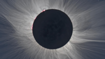
 Mom and I went to Mexico to see the eclipse.
We flew out on Saturday, to Monterrey, in the state of Nuevo Leon. It must not get a lot of traffic, as the airport only had one baggage carousel.
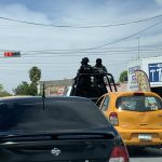
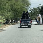
We had a car rented, so we went to the rental area. The attendant took our info and led us outside to get a van to the pickup area. While we waited, three pickup trucks go by, nothing unusual about that, except they had flashing red and blue lights and masked guards in the back along with a mounted gun. Crap, where have I decide to come?
I go into the rental building and the lady taking care of me doesn’t know any English, of course. She asks a few questions via Google Translate, but spends a lot of time tapping on the screen. She then has me “sign” the screen and runs my credit card. She takes me outside to the car, a Yaris. It is white (thankfully in that sun) and I immediately notice the lack of the metal portion of the gas tank cover and a large dent on the trunk.
There are also “streaks” in the trunk from luggage wheels. She documents everything and then Mom and I load up and leave.
I have the address for the hotel, but Waze gives me some bad directions. For example, it might say I need to turn left in 3.2 miles, so I get into the left lane, but as I get close, it suddenly changes to take an exit on the right. I would have no way to cross 3 or 4 lanes in such a short distance, much less doing it safely. I would have to continue on, and make a U-turn as soon as I could. I don’t know if this is common, but they do have many “retourno” lanes marked. I later tried Google maps, but got similar results.
After checking in to the hotel, we went out to get snacks and some water for mom’s CPAP. We ate out and then crashed out, it was only 8, but that’s 10pm back home and it was a long day.
 We headed out fairly early the next morning. It was 3½ hours to Torrèon, in the next state over, Coahuila.
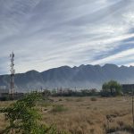
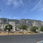
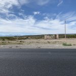
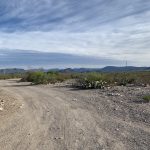
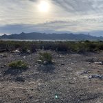
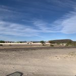
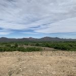
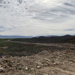
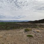
The drive was mostly uneventful, the town of Saltillo is near Monterrey, but there is almost nothing after that. We were mostly about a mile or so from a mountain range on each side of us, and just cacti and scrub bushes on a flat sandy ground between.
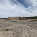
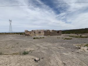
There were ruins of adobe buildings every so often. We stopped near one so mom could get a smoke, and I went behind to wee.
Occasionally, we’d come upon a small village. By small, I mean less than 10 buildings, total. Calling them villages is an exaggeration, but I have no word for anything smaller. The buildings also were better than the old adobes. At least one was obviously just pallets attached together to make walls and a tarp as a roof. There is very little rain, so that should be enough.
Most villages would have huge speed bumps to make you slow down. They were not so tall that the car would scrape the bottom, but they were not easy on the shocks (or our bodies). I’d have to go over at about 5km/h, otherwise it was too much. A few had local police ready to ticket anyone who didn’t obey. With the speed bumps, how could anyone speed? I couldn’t even get near the posted limit.
The car did not start out with a full tank, so I did have to stop. I think all stations are “full” service, I didn’t see any that you would be able to operate yourself. No different that New Jersey, in that respect.
It came to about 800 pesos, around $45, so no different than filling my car would have been. I was able to pay him directly, but mom had gone inside to buy stuff. Only I had all the cash, so I still had to go in as well.
I used the translator on my ipad to ask the service agent about checking the air in the tires, but he said something and shook his head no. That was another problem with the car, when I picked it up, the “check tire” light on the dash was on. I had done a check, by pressing on each tire, all seemed to feel the same. Crossing the desert with a low tire light is not fun.
We managed to get to the AirBnB in Torrèon a few hours early, so we started looking for lunch. I found a nearby place that had a sign advertising “street food” I ordered 2 of the “regular solos,” which apparently was just a cone of fries with sauce. They had no seating, so we sat in the car to eat. In the plaza, there was a Little Caesar’s with drive through line literally around the building. There was also an agua fresca stand (water with fruit), a cinema with all American movies, and another police truck with gun mount.
There is a securiy gate at the AirBnB, but it was open all weekend, fortunately, bandits take Saturday and Sunday off, so we were safe.
We went for some breakfast food, since we had a kitchen and a fridge. Honey Cheerios do not taste anything like Honey-nut Cheerios. Perhaps because they are made by General Mills, here, but by Nestlé in Mexico. The orange juice was good, but a little bitter.
First thing Monday morning, I made a bunch of peanut butter and apple marmalade (which had small chunks of apple) sandwiches to take to the eclipse. I wanted to eat something local, but I knew that there would be a lot of people there and I didn’t know if many places would even be open. The peanut butter was unusually smooth, no risk of tearing your bread.
Nazas, in Durango state, is a small town. There was a group of police at the start of town (of course) and some locals handing out flyers listing various events that were going on. The flyer also had phone numbers at the bottom that we could call and someone would translate for us, for free. I know that no one here would do that.
I had a spot picked out north of town, down a small dirt road. It looked good on aerial view, but Google had no street view, so I didn’t know if I’d have been able to pull off safely. There could have been a fence or a “curb” where road graders had dug down.
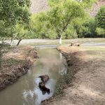
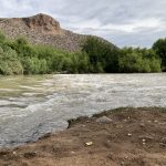
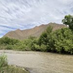
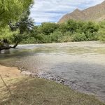
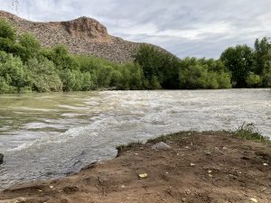 We decided to try out the local’s event. Following signs down a very dusty road, we wound back to a small park next to Rio Nazas, a modest, but fast moving river.
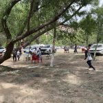
There were lines drawn out onto the ground for campsites, which many had taken advantage of. They had a section filled with various food vendors as well as the obligatory trinket hawkers.
They played music from speakers on a raised stage, that they also “narrated” the eclipse from. From what I listened to, it was all American music. So much for “local culture.”
The sand was super fine, like confectioner’s sugar. This must be what walking on the moon feels like. Unfortunately, it was too easy to kick up and my shoes were quickly nasty looking.
Someone offered mom their chair in the shade. I then noticed really tall grass nearby, it was wild corn growing beside the river. No ears dang it. On the ride back, I did notice some occasional bunches of corn near the highway. It must fall out of trucks.
I briefly spoke with a Japanese man from near Tokyo, who came all the way just to photograph the eclipse. I suppose that’s no crazier than the two of us going.
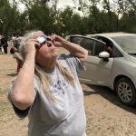
The eclipse at that location was about 4:28 of totality, the longest along the entire path, hence our reason for being there. It really didn’t feel like it was that long. There was just one bright spot (a Baily’s bead) near the lower right.
In 2017, I saw mini eclipses on the ground, because of the thousands of gaps between the leaves, acting as camera obscuras. I saw the same this time, but the trees were mostly long needled, so the effect wasn’t as pronounced. Also the kids I pointed it out to, either didn’t care or didn’t understand.
After the end of totality, most people were leaving. There was more to see of the eclipse, but most don’t care. There were other events going on, including live music and a canoe race down the river.
We waited, but still managed to get stuck in the traffic.
I didn’t see anything on the route out of town, so good thing we had sandwiches.
After getting back to the room, we washed the dust off and then went out to eat.
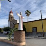
One of mom’s patients told her about a statue of Jesus, the largest in North America. I found it on the map and figured it would be better to go there first before the restaurant. Once we arrived, there was a small walkway going up the side of the mountain. Hell no, neither of us was going to climb a mountain on foot. So we skipped it.
While sitting at the restaurant, on the 2nd floor, I am looking around at the scenery and spot something atop another mountain. I pull out the iPad map and it was the statue we had been looking for. I have no idea what the first place was, it was 30 minutes away, so definitely not the same. I couldn’t find it on the map again, either.
I had a “Hawaiian” burger, 2 beef patties with small ham cubes and chunks of pineapple. I don’t understand why people want to make tall burgers, if it is larger than my mouth, it is too big. It did taste great and had a wooden skewer holding it together, which I poked myself with several times as I ate.
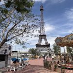
There was a park next door, with carnival rides and such, so we browsed it briefly, before going to see the statue.
It was about 20 minutes away, so as I’m driving up, it is getting dark, the first time we’ve stayed up long enough to see it. The parking area is only partway up the mountain, so we would still have to climb. Again, no.
Strangely, with the majority of Mexicans being Catholic, I only saw a small number of churches, maybe 4 total. There were small shrines along the roadways, however. Even 20 miles from any building, there one would be. Who was visiting or maintaining these?
All the fun was over, we had to drive back to Monterrey to fly home. If there is one thing more boring than driving through a desert, it has to be driving the same road again.
I had originally decided to drive along the freeway, partly to see the local sites and stop if desired, and partly because I didn’t want to pay a toll and then have the rental company charge me again.
Well, there really were no local sites to see, and the toll was about 22 bucks, so I was going to risk a small double charge.
The freeway mostly travels between the mountains, on the level ground. The toll road travels mostly parallel, but does go through more passes. At one point, we are going uphill. There seems to be a half lane on each side. I see a couple of semis, without trailers, riding along this half lane. I presumed it was so I could see past them if I was to pass. Nope, it was because 2 trucks, with trailers were basically riding across the center line, passing others on their side. Geez.
I notice some electronic signs, something about migration of monarch butterflies. I saw a few pale yellow butterflies, but I think monarchs are orange.
I really wish I had a camera on the front of the car with a screen that had live translations. Too many signs I have no idea what they meant. I am certain I broke a law or two, simply because I didn’t know better.
Some of the multi-lane roads had different speed limits for each lane, like 60-50-40 km/hr, with them painted on the roadway, but most were worn away or faded.
On the way to the airport, I see a couple of men trying to chop the flower stalk of a yucca or agave plant in the median. I had presumed they didn’t want the more than 20 ft tall stalk to fall into the road, or that they didn’t want the plant to spend energy on reproduction. But shortly after getting home, a video was posted that compared asparagus and agave plants. Perhaps they were going to eat it.
