Arrival at Winterfell

Looking around Belfast, we really didn’t see much to do, especially on a weekend. That’s bad planning on my part.

While Mom was in the shower, I scrolled around the map this morning and spotted something that sounded interesting. Off we went to Castle Ward.

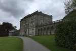
After parking and getting a map of the grounds, I see that there are several filming locations for the HBO series Game Of Thrones.

I had seen many of these pop up on searches for locations to see in Ireland, but none of them seemed important, mostly “X met Y here and then they left” scenes, that had little recognizabilty.

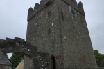
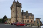
While the castle itself was not filmed, there was the tower Bran climbs in episode 1, a battle field, and “crossroads” where several scenes had taken place.

The tower was actually the original castle, before the family built a newer home in 1763.

There was also another castle on the estate, Audley’s Castle, which stands in for the outside shots of Lord Walder Frey’s house, “The Twins”.

We walked around the gardens a bit and looked through the manor house, before a light rain started, so we went back to town.

There is an indoor street market, with people selling their crafts and cooking up various foods.

We bought some paella and watched the jazz performers, who weren’t that bad, then had some crepes before the market closed.

We leave first thing tomorrow, so we had to head back to pack everything up.

[supsystic-gallery id=23 position=center]

Carrickfergus

Carrickfergus is a small town northeast of Belfast, but predates it by a century.

We went to the castle this morning, taking a short tour before browsing on our own.

The castle was used right up until after WWII, where it was used partly as bomb shelter.

Later we went downtown, but there isn’t any parking available. We saw a Hop-On bus and followed it for a bit, looking for where it had stops. Its only stop, that we saw, was at the Crumlin Road Gaol. Being outside the main downtown area, we found a spot and went into the jail for a tour. Afterwards, we had just missed the bus, and we were hungry, so we went back to the apartment to eat.

After a nap, we drove over to the Belfast Castle. Unfortunately, it is mostly a banquet and event hall, nothing much to see indoors. There was a large walking path, but we have already had enough walking this month.

There is also a restaurant downstairs, and we went in for dinner.

[supsystic-gallery id=22 position=center]

Carrick-a-Rede

I awoke early this morning, and I saw that the car parked in front of me had left, so I took the opportunity to back the car into the street and turn it around so I could back up the steep hill and park in front of the apartment. This made loading our bags into the car much better, but the car groaned mightily trying to go up the hill.

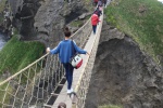
We had to leave Derry for Belfast. We had been to the Giant’s Causeway a few days ago, but had over looked the Carrick-a-Rede rope bridge nearby. With a small detour to the trip, we headed out to the north coast, yet again.

As we arrived, the sun was just starting to peek out against the clouds, enough that we could see mainland Scotland better than before, plus it was larger.

The map sign showed puffins on the little island past the rope bridge, but they are either too small to see or too good at hiding.

It was only a 1km hike down to the rope bridge, but it was a lot of up and down the hills.

Once across, the grass is lush and green, with small white and yellow flowers all over, plus a golden moss or lichen covers the rocks. Very pretty, but also slippery.

After our hike back, we went into the “tea room” to get something. We both had corned beef sandwiches and a drink. My drink was a lightly carbonated elderflower beverage. It was a bit strange tasting, but not bad.

We then drove down to Antrim, to see the Antrim Castle. Slight problem, the castle burned down in 1922, so there is only a stepping stone outline of where the castle was. Lame.

Near the castle site, there is a hill with a trail circling around to the top. We went up, but there wasn’t anything there, not even a statue or plaque. More lame. Even the view up there wasn’t that great, it looked down on 2 grassy areas and a brick wall.

There were some gardens to browse around, but we had already seen several that were much better.

Time to head to the apartment.

[supsystic-gallery id=21 position=center]

Downtown Derry-Londonderry

We really haven’t spent much time in any cities since Dublin, and there wasn’t much to see around anyway, so we walked down, across the bridge to the city walls. Derry has one of the few double decker bridges in Europe and has the only remaining “full” city walls, they were never breached.

Derry is a city full of past trouble. It is the battle ground between the Irish Nationalists (for a free Ireland) and the Unionists (loyalist to the UK crown). Even the name of the city is rife with difficulty. The legal name is “Londonderry”, but it has long been called just “Derry” also.

The city was even a center to the turbulent times referred to simply as “The Troubles.” This was a time of terrorist tactics of shootings and bombings of public places, starting in the 1960’s and having deaths as late as 2002.

We ambled along, enjoying the sights, nothing really new or noteworthy, but enjoyable. Until mom spotted a Hop-On bus sign. Wait a minute, I bought tickets for the Derry Hop-On bus before we left, Unfortunately, the bus here only makes one round per hour, so we had to wait 30-40 minutes.

We took the whole tour, coming back to where we started, mainly because the driver never stopped at the places he was supposed to stop. Also, nothing looked interesting enough to stop at.

It was just a mile to the house, so we went across the Peace Bridge and walked down the street.

Ready for a nap.

Footsteps of giants

We started off going to Dunluce castle, but just before getting there, there was a large pull off area. What the heck, let’s stop and see what is there.

Not much really, but it was pretty. It was also very cold and windy. The only benefit was that we could just make out Scotland on the horizon, just the Isle of Islay. We could just make out the Dunluce ruins from there as well.

We drove around the corner to the Dunluce, but they wanted too much admission for such a small place.

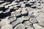
Next up, the Giant’s Causeway. Not much to say about that directly, except they are mostly long hexagonal, pencil-shaped rocks, that formed as the lava cooled.

There was a long downhill walk to get to the rocks on the shore. The cold wind was biting. Once down to the formations, the wind mostly was blocked by the surrounding mountains.

There is a walkway cut through the formations, to allow access to the next “beach”. There are many coins jammed into the cracks in the rock, like a wishing well. Many of the coins had corroded from the salt and now are pushing the stones apart.

About 45 minutes into our trip to the Beaghmore Stone Circles, we realized that we had missed the Carrick-a-Rede Rope Bridge. Oh, well, maybe we can still see it later.

We reached the circles and listened, there was silence. The sign stated it was the darkest sky in Northern Ireland, which probably means the furthest from any city.

[supsystic-gallery id=19 position=center]

Donegal

We packed up and left the freezing cottage this morning. They only seem to run the boiler for a few hours at a time, so the place never gets “warm”

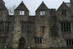
We stopped off in the city of Donegal, at the Donegal Castle. It was more of what we would think of as a house, but it did have a wall around it. We arrived a bit early, they weren’t open yet, so we had to stand in the drizzle. Can’t complain much, the weather has been mostly clear and warm (for Ireland).

Then we went to a home in the National Park, Glenveagh Castle, again, not a castle, just a manor house.

On the way, the terrain changed dramatically. We were on a road with a bit of greenery next to it, but everything else we could see was brown and “dead”. Probably just hibernating.

Glenveagh went through several owners throughout the years, including 2 different Americans, who became the Earl of the house.

I was following the Google directions, but we were on the wrong road. Actually, it wasn’t a road, it was the bus path to the castle. I saw a bus coming, so I backed up a few dozen feet to a wider spot, so they could pass. The driver stopped and informed us we were going down the wrong path and redirected us to the car park. Turns out I was was almost there.

We had a long wait for the house tour, so we spent time walking around the gardens, still in the drizzle. There was a large group of 12-14 year old girls, obviously on a field trip. Fortunately, they were not part of our house tour, but there was a bus tour group that was, so it was a bit crowded.

There is a watch tower on the coast, almost straight north from Glenveagh, the Horn Head. I have no idea why it is called that, but it was cold and windy.

There was a small stone “hut” where the sentry would stand out of the wind and rain, while searching for invading ships.

I was uncertain if the car was going to make it up the steep road.

We stopped off in the nearby town at a cafe for lunch. I decided to try the Sprite. They have Fanta orange, but it is more like Tang. The Sprite wasn’t labeled at diet, but it had no sugar. I kind of feel sorry for a diabetic who comes to the US and drinks a regular Sprite, they would spike their blood sugars.

We tried to see another castle, but we arrived just before 5 and the gates were already closed. Bummer.

We then headed for our new “home”, well home for at least for a few days, in Derry/Londonderry. There is an ongoing dispute what the name of the city is or should be. Check Wikipedia for an interesting tale.

The place we are staying is at the very top of a very steep hill. Think San Francisco streets and multiply by 2. The roadway is too narrow to turn around, so I have to back down into traffic, no big deal.

[supsystic-gallery id=18 position=center]

More caves and gardens

We set out for the Marble Arch caves, just across the border in Northern Ireland. We were about half way when Mom realized she didn’t bring her British pounds, all we had were Euros, but they did accept credit cards, so no problem.

This cave system had an entrance that was a lot less steep than the Mitchelstown caves.

After a short walk, 6-7 minutes, stopping to view interesting formations and get history, we arrived at the end of the area we could walk. The cave is normally flooded, so we climb into boats and continue our tour, in style. At least as much style as one can have in the dark, while being dripped on by water soaking through the rock, and ducking our heads to miss low hanging ridges.

Alas, our ride wasn’t for the whole trek, we had to dock and continue on foot, like peasants.

There was a short segment that had no handrails or walls beside us, just water flowing on both sides of us. It was kind of strange, knowing that if the water level increased just a touch, we’d be walking in the water.

The guide would stop and allow everyone to reassemble. At one of these stops, I was looking down at a small “valley” and was just thinking about taking a picture, when it rippled. It wasn’t a valley at all. I was looking at the reflection of the ceiling in the very still water.

At this point, the guide explained that originally they would have to end the tour here, the roof was too low to allow another boat crossing. But some smart dude had the idea of splitting the sea like Moses. There was a walkway with short walls on each side that held back the water, allowing us to continue walking.

After completing the tour, we climbed stairs through what looked like a WWII steel bunker tunnel. At the top, we waited for remainder of the group, then passed through another door, only to find 150 more stairs on the outside to climb. Mom was winded, but so was I.

There was absolutely no cell signal there, but I did know that our next destination was just a few minutes down the road, no map needed.

We were at Florencecourt, a still functioning farm manor house. We bought our ticket for the next tour, but it was an hour and a half wait, so we strolled around the gardens and had a bite in the cafe.

Many of the building were no longer needed, like the carpenter shop, laundry, or the saw mill, and were converted into small museum sites. Part of the tour took us into the original kitchen and servant’s duty rooms. It really did feel like Downton Abbey.

Originally, the plan was to go to an abbey, but after buying the tour tickets, I realized that this tour would not be over soon enough for us to drive to the abbey before the last entry. Instead, we found another museum nearby, the Enniskillen Castle Museum. A museum about castles? We weren’t sure what it was about, but we’ve seen so much Irish history, but really haven’t learned anything about current Ireland. Turns out it is a museum inside what was a garrison, not what we would think of as a castle.

It was only 25 minutes before closing so the clerk didn’t charge us, but we didn’t have a lot of time to see it all. It turned out it was a tribute to the local soldiers in WWI, WWII, and the Napoleonic war. History, but at least more recent history.

Glencar and entering the UK

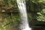
We stopped off at a small water fall this morning, Glencar Falls. It is only 50 feet or so high, but the largest we’ve seen so far.

I spoke with someone there about if there is any path to drive up the mountain. He didn’t really give me an answer, but he did tell me about trees that were planted on the mountainside, with the light and dark trees forming a Celtic knot. I’m not sure if it is true, I didn’t see it.

Then we headed for the Organic Center, where they teach about responsible gardening and soil management. It mostly looked like any Lowes or Home Depot garden center, even most of the plants would be the same.

We jumped over the border into Northern Ireland, just for the heck of it. There was barely even a sign letting you know, definitely no crossing guards.

Driving around aimlessly, I stopped at a stop sign (because you’re supposed to) and suddenly noticed an old castle right next to me.

I found parking right there and we walked up. A sign on the castle gates stated we needed to enter through the cafe. There were several signs stating that the cafe was now open, but the cafe operators obviously did not read them, their door was locked.

We made a very quick stop at the Sligo Abbey ruins, in downtown Sligo, before going back to the Aldi to get some things we needed, like dish soap and salt, things that should have already been here.

Onto to Sligo

I was tired yesterday, going to bed at 8:30, without the sun going all the way down yet. But we did arise early enough to get a fresh start on the nearly 4 hour drive.

There was really nothing en route for us to stop and see. We arrived in Sligo (pronounced sly-go) about 1:30, and weren’t supposed to check in until 4, so we detoured and followed signs for Parke’s Castle.

It is a small 3 story 17th century castle, right next to large Lough (Irish for lake) Gill, surrounded by mountains. Totally worth the admission price, well, it was free since the courtyard was under renovation, still enjoyable.

There was a small “lay-by” beside Colgagh Lough where we pulled off the road and took a few pics of the view.

We still had plenty of time to kill, so we tried to find the Sligo Gaol, but it seems to now be just another government complex, with bars on the windows, at least the employees can’t escape.

Hungry, we tried to find a quick bite, but there wasn’t any parking along our route, until there was a Texaco station with a restaurant inside. Semi cafeteria style, where you tell the lady what you want, and she puts it on the plate. Wasn’t bad, but wasn’t great either.

We went ahead and drove to the AirBnB and I crashed out for 2 hours. When I arose, mom was sitting in a chair, also crashed. Perhaps this is going to be a lazy evening for us.

Cliffs of Moher

We went to the Knappogue Castle, but there didn’t seem to be anyone around.

Google said they were open daily at 10, it was almost 11.

Mom found later that they are not open to the public. That is lame. If you don’t want me in, shut your gate and don’t put up signs that encourage me to come.

We headed to the Cliffs of Moher, on the west coast of the island.

It was very beautiful, vibrant green grass with yellow dandelions, deep azure blue water, and pure white waves breaking against the rocks below.

But, it was cold, around 50° and the wind was blowing hard, since there was nothing at sea to slow it down. It had rained as we drove, but the sky cleared and the sun helped warm it just a touch.

We had to climb the walkways to the top-most point, several hundred feet above the car park, huffing and puffing, with small kids just bounding past us as if gravity worked oppositely for them.

Then we had to come down and go up the other side. I specifically chose that order, because there is a watch tower on the second summit. If we had gone there first, Mom wouldn’t have wanted to go up the “plain” side.

A small plane flew past a couple times, we were higher than the plane. Ridiculous.

Somehow, Mom always has stamina to still go through the gift shops, despite all of them having the same crap, … um, I mean they have quality merchandise, chosen specifically for each site.